Mapping Services
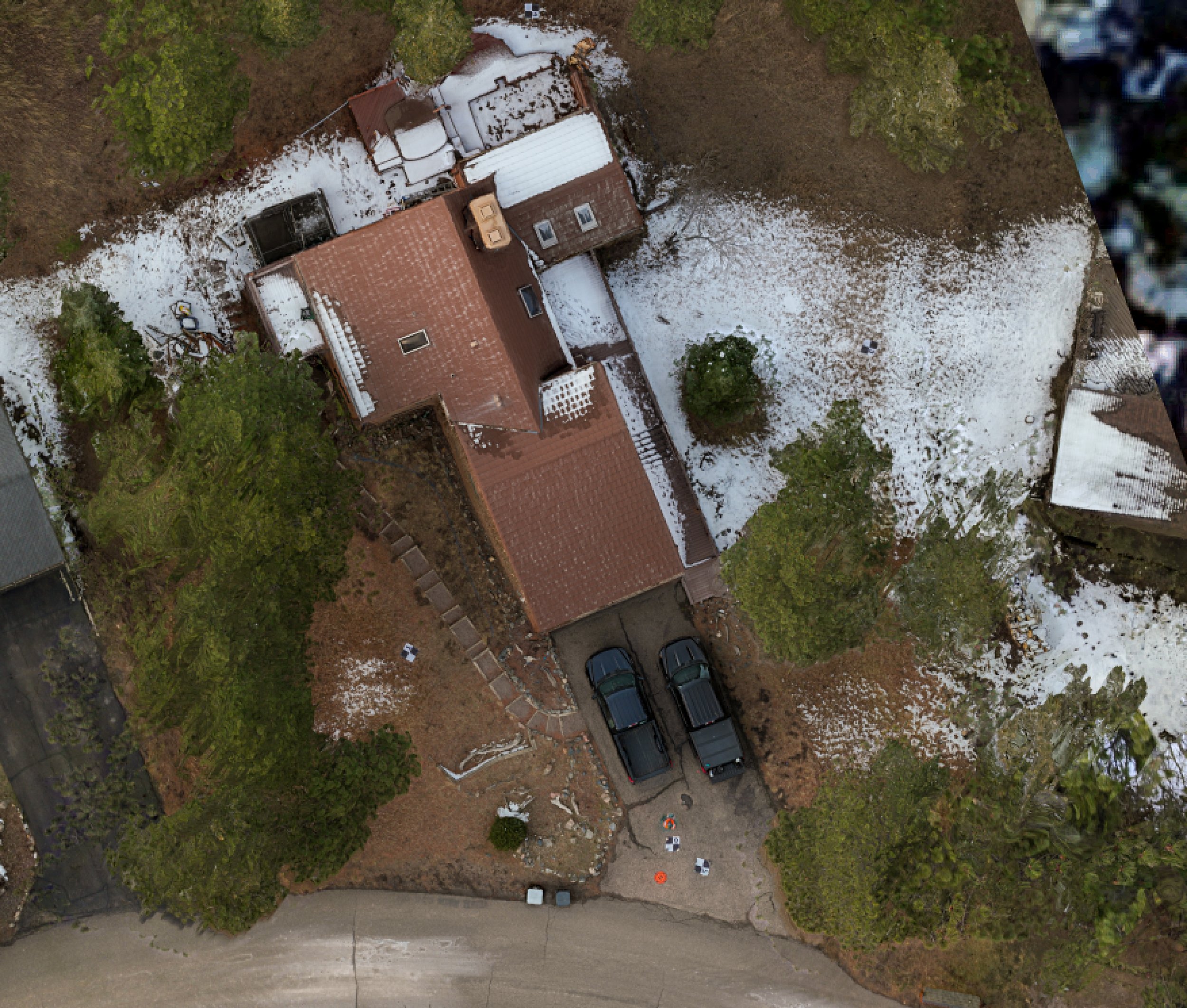
Orthomosaic Maps
Know exactly what’s happening on your site.
A high-resolution, scaled aerial image created by stitching together hundreds of drone photos. Orthomosaic maps are corrected for distortion and scale, making them ideal for measurements, planning, and site documentation.
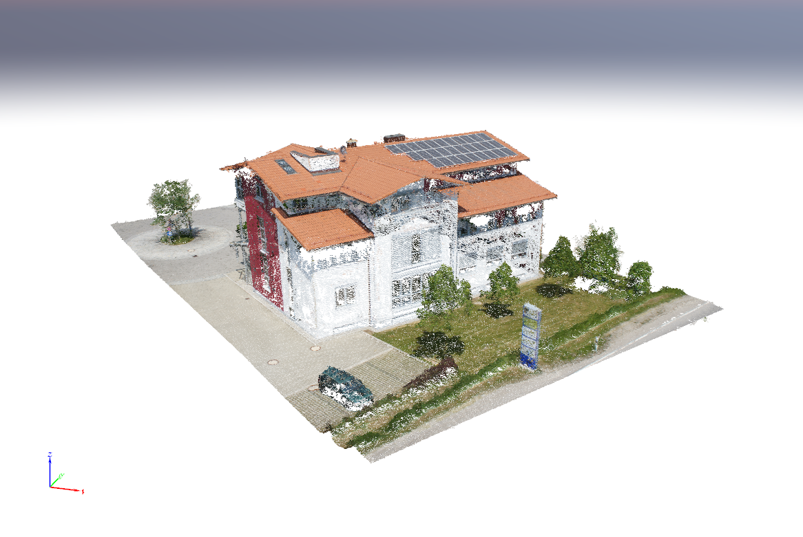
3D Point Cloud
Data optimized for analysis, removing guesswork.
A dense collection of millions of spatially accurate points that represent real-world surfaces and structures. Point clouds are commonly used for measurements, modeling, and integration with CAD, BIM, and GIS software. They also serve as the base data set for the other products mentioned below.
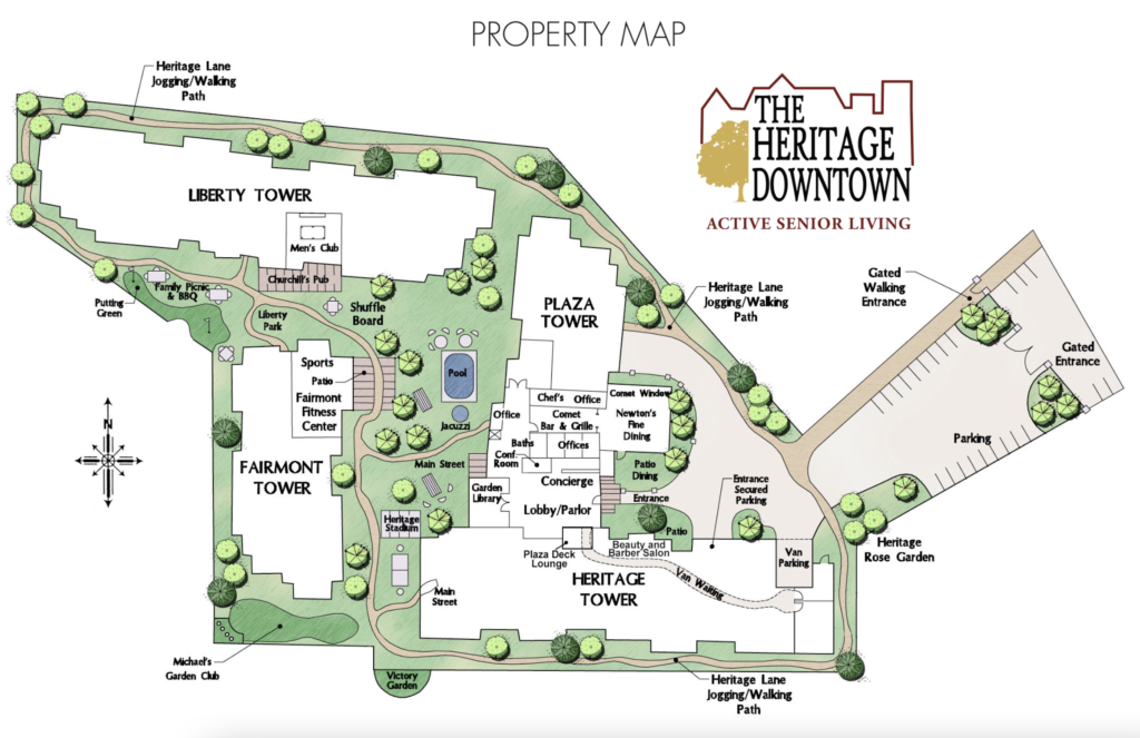
Thematic Maps
Information tailored to your audience, customized by you.
Custom maps that highlight specific features or data, such as vegetation health, surface materials, elevation ranges, or areas of interest. These maps help turn aerial imagery into actionable insights for analysis and decision-making.
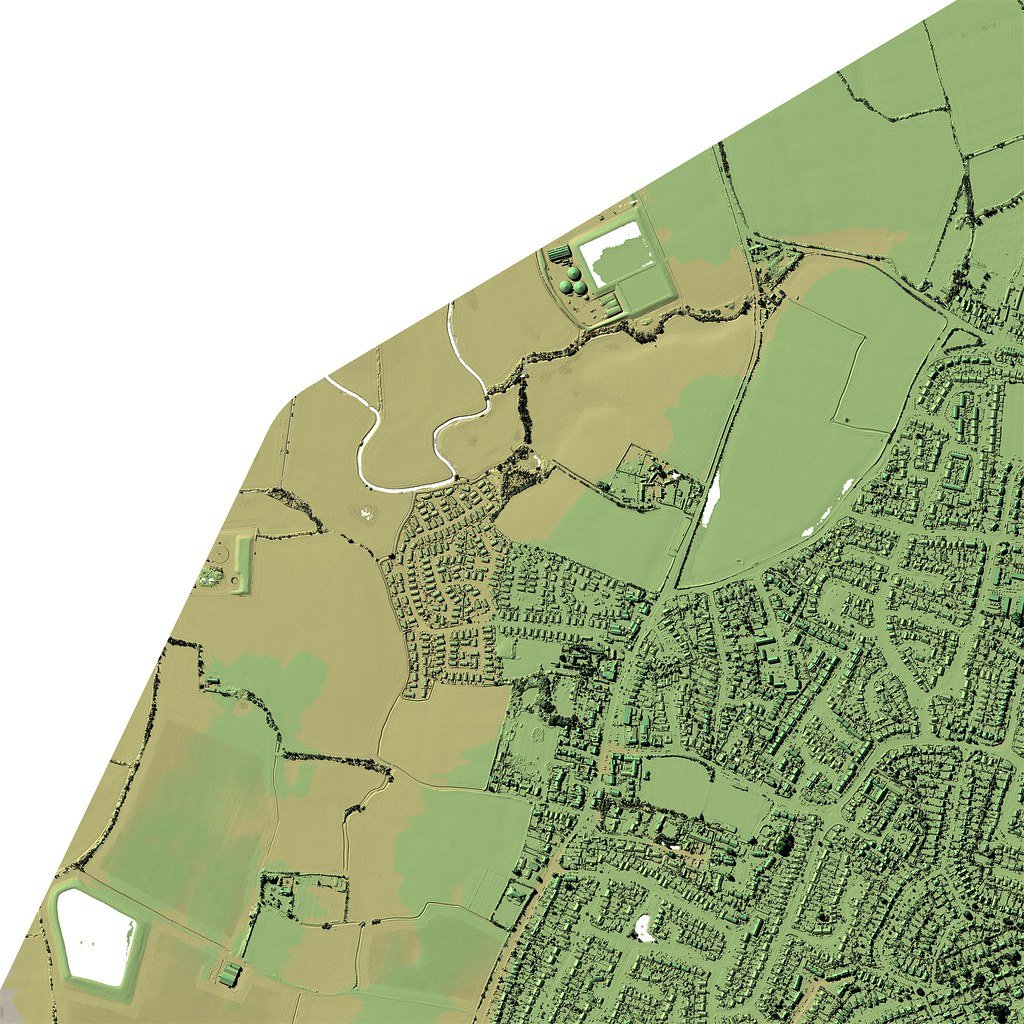
Digital Surface Models (DSMs)
See deeper insights with a hyper-detailed 3D model of your site.
A 3D representation of the Earth’s surface that includes everything on it—buildings, vegetation, equipment, and terrain. DSMs are commonly used for volume calculations, line-of-sight studies, and site planning.
Digital Terrain Models (DTMs)
Visualize your land surface without anything on it.
A refined 3D model of the bare ground with buildings and vegetation removed. DTMs are ideal for earthwork planning, drainage analysis, and understanding natural terrain before development.

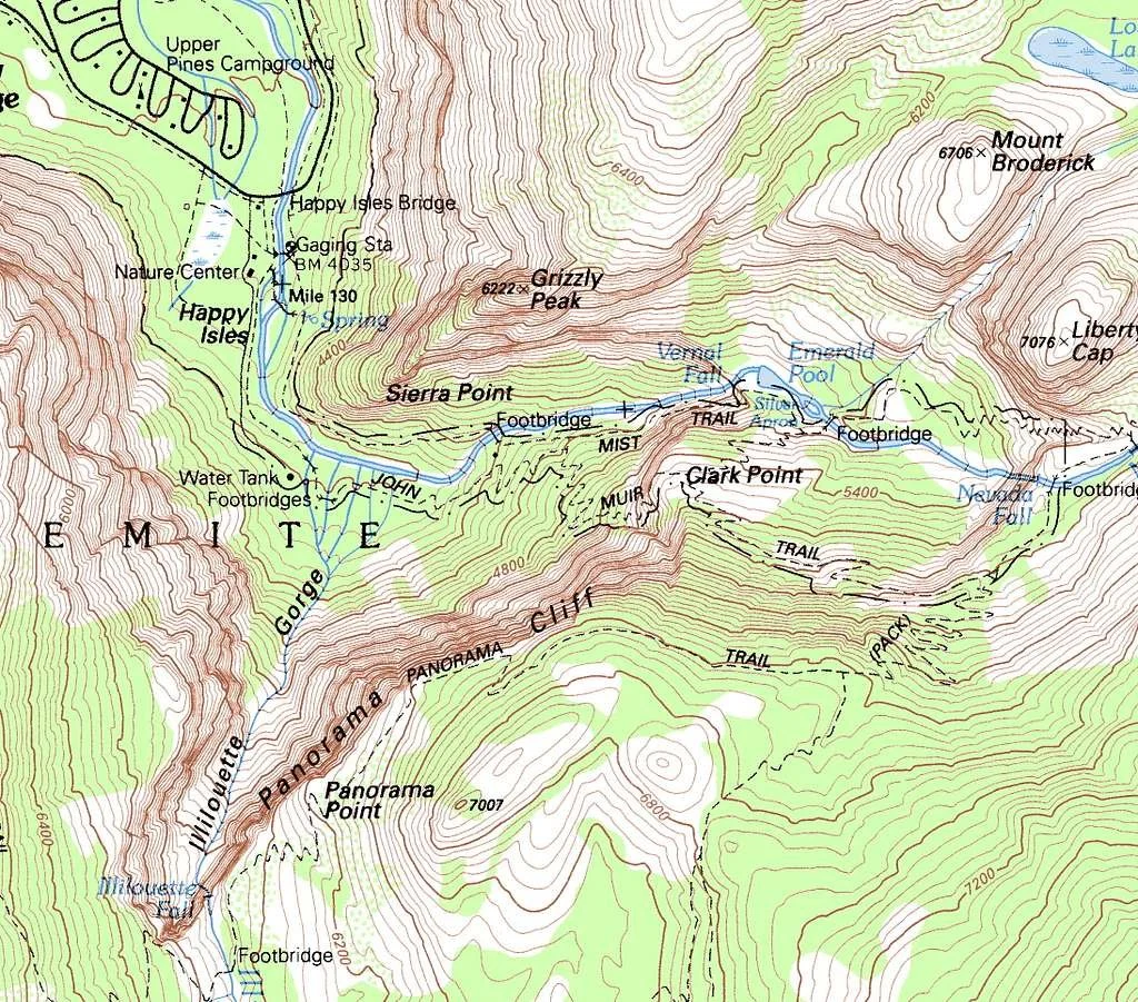
Topographic Maps
3D terrain visualized on a 2D surface, in a classic way.
Detailed maps showing elevation through contour lines and spot heights. Topographic maps are useful for construction planning and understanding slope, drainage, and landform changes across a site.
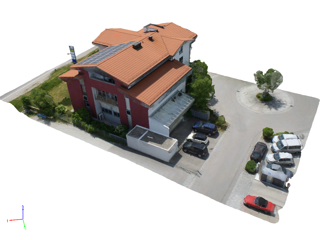
Textured Mesh (3D model)
Also known as a “digital twin”, see your entire site in one 3D space.
A realistic 3D model created by wrapping high-resolution imagery over a 3D surface. Textured meshes provide an immersive, true-to-life view of structures or terrain and are ideal for visualization, presentations, and virtual site walkthroughs.